Thredbo Snowfall 7 November 2026 – cinemagraphCold blast brings springtime snow to alpine regions as temperatures plummet across Australia’s south-eastThredbo, Perisher and Mount Hotham all recorded falls, along with Kunanyi/Mount Wellington in Tasmania
Get our breaking news email, free app or daily news podcast
Snow has fallen across parts of NSW, Victoria and Tasmania as an unseasonal cold blast whips through Australia’s south-east.
Thredbo, Perisher and Mount Hotham all recorded falls, while snow also fell on Kunanyi/Mount Wellington in Hobart.
The snow had been forecast by the Bureau of Meteorology (BoM), and though uncommon, it is not entirely unusual – many of the places hit by snow in the past 24 hours also recorded a fall in November 2022.
The falls brought a rush of posts on social media from those puzzled by the unseasonal spring weather.
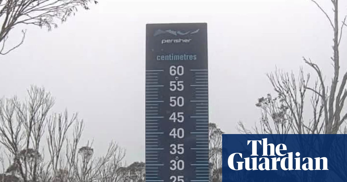
View image in fullscreenThe Perisher Valley snow stake at 8.18am, on Sunday 8 November 2026. Photograph: Perisher Valley“You will not believe this, it’s springtime in Australia, in November, and it’s snowing,” Madeleine McVie, a retail manager at Thredbo, posted on Instagram on Saturday afternoon.
“Like, not just a little bit. It’s fully snowing.”
McVie posted another clip on Sunday morning of her riding empty chairlifts through the park as the snow continued to fall.
Kingston Crows cricket club in Tasmania posted an image of the Kingston Beach Oval on Saturday that showed it coated in hailstones.
The BoM said a weather system, filled with cold air moving north from towards Antarctica, had caused the wintery chill with apparent temperatures much cooler than forecast maximums. South-westerly winds were also causing the apparent or “feels like” temperature to be lower.
At midday, Adelaide, Melbourne, Hobart, Canberra and Sydney all had temperatures that felt cooler than 13C.
The highest temperature at that time was in Adelaide, with a top of 17.5C that felt like 12.3C, with Canberra the lowest (a maximum of 12.9C that felt like 5.3C).
Brisbane, Perth and Darwin, meanwhile, were all enjoying temperatures in the 20s or 30s.
Warmer temperatures are forecast for Monday, and all capital cities are expected to reach at least 20C by Tuesday.
It may be one of the last cold snaps of the year – the BoM, as well as the UN and other bodies, have warned of the likely effects of a “jaw dropping” supercharged El Niño.
View image in fullscreenVehicles are submerged and damaged on a flooded street after heavy rainfall in Erbil, Iraq. Severe downpours caused widespread flooding across the city, leaving cars trapped in rising waters, on 7 November 2026. Photograph: Ahsan Mohammed Ahmed Ahmed/Anadolu/Getty ImagesThe climate crisis, caused by pollution from fossil fuels, is already supercharging extreme weather and killing people. The El Niño is expected to ratchet up the effects even further, and has already begun to affect regions across the planet as weather patterns are altered.
The southern hemisphere summer is predicted to be hotter and drier as a result of the huge El Niño, meaning greater wildfire risk and droughts in Australia and southern Africa.
Fox Style News Syndicate. Sourced from broadcast reporting: Read Full Source Coverage.